On August 18, 2026, the U.S. Forest Service filed a formal proposal to get rid of the 2001 Roadless Rule entirely. The agency's stated reason is wildfire: it says the rule's ban on new roads makes it harder to fight fires and thin out dangerous fuel buildup in the backcountry. That's a testable claim, and we already had the pieces to test it — a wildfire perimeter database and the Forest Service's own roadless area boundaries. So we ran the numbers ourselves.
The short version: fire has clearly gotten worse across the country since the 1980s — including inside roadless areas. But so has fire everywhere else. When we ran the numbers accounting for that nationwide trend, we found no statistically significant evidence that the Roadless Rule itself is responsible for any of it.
What Is the Roadless Rule, Actually?
Passed in 2001 under the Clinton administration, the Roadless Rule identified about 58 million acres of National Forest land — places that aren't official Wilderness, but also don't have roads built into them yet — and blocked new road construction and most logging there. The idea was to keep the last big unroaded chunks of national forest from getting chopped up before anyone decided whether they should become Wilderness or stay open to more development. It's been fought over in court more or less continuously since the day it was signed.
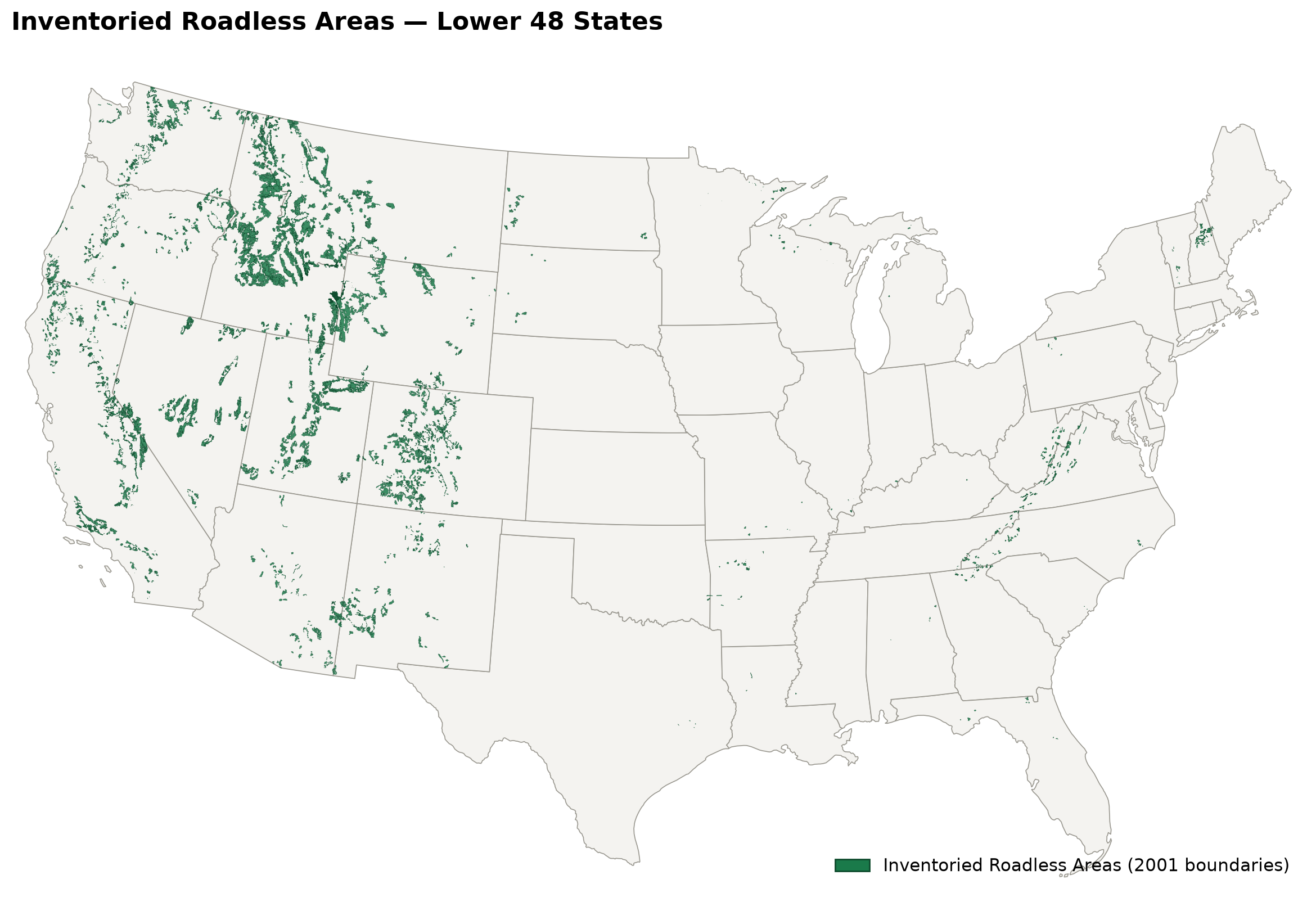
Inventoried roadless areas, Lower 48 states · USDA Forest Service 2001 boundaries · OutsideDB spatial analysis
How We Checked It
We used two datasets. First, the Forest Service's own official map of the 2001 roadless area boundaries. Second, a historical database of wildfire perimeters — the actual mapped outline of where every fire burned, not just a point on a map. Using GIS (geographic mapping software), we overlaid every fire's outline onto the roadless boundaries and calculated exactly how many acres of each fire fell inside roadless land versus outside it.
A few choices we made along the way, and why:
- We focused on the Lower 48 states. Climate and fire behavior vary enormously across U.S. regions, so keeping the comparison to one consistent climate zone gives a cleaner read than a mixed national number would.
- We compared 20 years before 2001 to 20 years after. Specifically 1981–2000 versus 2002–2021, with 2001 itself included on its own. That gives an even, symmetric window on both sides of the policy change.
- We measured acres burned, not fire count. A handful of huge fires matters more to the landscape than a lot of small ones, so total acreage is the more meaningful number here.
Acres burned inside roadless areas vs. total, and roadless share of total burn · 1981–2021 · Lower 48 states · OutsideDB spatial analysis
What We Found
Fire has increased substantially over time, both inside roadless areas and outside them — that part is clear from the chart above. But that alone doesn't answer the real question we set out to test: was the amount burned inside roadless areas statistically higher than what burned outside them, once you account for the fact that fire has been getting worse pretty much everywhere?
But Did the Rule Actually Cause This?
Fire has been getting worse everywhere for the same 40 years, for reasons that have nothing to do with this rule — drought, a warming climate, decades of built-up forest fuel, longer fire seasons. A rising tide was lifting every boat. The real question is whether roadless land rose faster than that general tide would explain on its own — not whether it rose at all.
To answer that fairly, we ran a statistical test called a difference-in-differences analysis. In plain terms: we compared the change inside roadless areas to the change outside roadless areas, over the exact same years, so that whatever was driving fire activity everywhere gets cancelled out — leaving behind whatever might be specific to being inside a roadless boundary.
In other words: once you account for the fact that fire got dramatically worse everywhere over this same 40-year stretch, the increase inside roadless areas is not statistically distinguishable from that broader nationwide trend. There is no solid evidence in this data that the Roadless Rule is contributing to today's wildfire problem.
Bottom Line
Wildfire has genuinely gotten much worse across the country over the past four decades, including inside roadless areas — that part isn't in dispute. But the data does not support the idea that the Roadless Rule caused that increase. Once the nationwide wildfire trend is accounted for, there's no statistically significant link between roadless status and the rise in fire. If wildfire risk is the justification for repealing the rule, the numbers don't back that argument up.